
Neve Eli Ezer is a climb of 9.8 kilometers (category 1). Neve Eli Ezer tops out at 663 m above sea level. It is located in מועצה אזורית מטה יהודה, מחוז ירושלים, ישראל. The average gradient is 4.4% with a maximum of 13.2%. The climb has 436 meters of elevation gain.
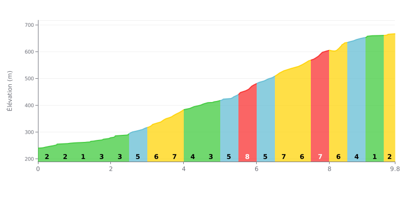
Climb difficulty: This category 1 climb has an uneven profile. The main challenge is a demanding middle section, with gradients of 7% and 8% between km 3 and km 6. The final part is more manageable, with the gradient easing progressively after km 8.
Tips for pacing the climb:
1. Managing your rhythm: Start easy over the first few kilometers (1-3%) to save your legs for the hard part.
2. Focus on the middle section: Expect a sustained effort between km 3.0 and km 6.0 (7-8% gradients). Pick a gear you can spin comfortably and keep a steady cadence to get through this critical stretch.
3. Recovering near the top: Use the section where the gradient drops to 1-2% over the last kilometer to ease off and recover before the summit.
9.8 km • 436 m D+
VAM: average climbing speed, based on elevation gain


Join thousands of cycling fans! Plan your rides, record your performance, track your progress and discover the finest climbs.
Live climb profile to pace your effort all the way to the top.

