
Tai Mo Shan is a climb of 10.1 kilometers (hors catégorie). Tai Mo Shan tops out at 917 m above sea level. It is located in 元朗區 Yuen Long District, 香港 Hong Kong, 中国. The average gradient is 9.6% with a maximum of 18.6%. The climb has 972 meters of elevation gain.
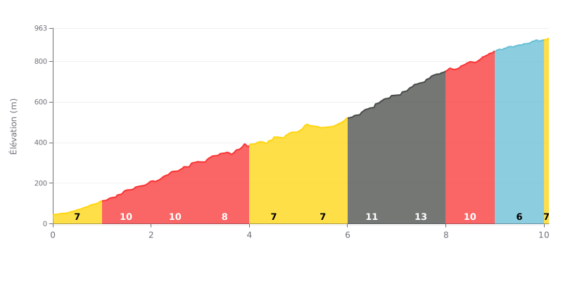
Difficulty breakdown: This Hors Catégorie climb covers 10.1 km and is tough because of its high average gradient (9.6%). The difficulty peaks at the end, with sections of 11% and 13% between km 6 and km 8, after a slightly "easier" stretch.
Tips for the effort:
1. Pacing: Start steady over the first kilometres (6-7%) so you still have something in the tank before the steepest pitches.
2. Save something for the final ramp: Keep some legs and some head for the crucial stretch between 6 and 8 km, the steepest part of the climb.
3. Active recovery: Use the last two kilometres at 6% to ease off a little and finish strong.
10.1 km • 972 m D+
VAM: average climbing speed, based on elevation gain


Join thousands of cycling fans! Plan your rides, record your performance, track your progress and discover the finest climbs.
Live climb profile to pace your effort all the way to the top.


Within 20 km