
Malá Lhota is a climb of 4.9 kilometers (category 2). Malá Lhota tops out at 627 m above sea level. It is located in okres Vsetín, Střední Morava, Česko. The average gradient is 6.2% with a maximum of 13.5%. The climb has 303 meters of elevation gain.
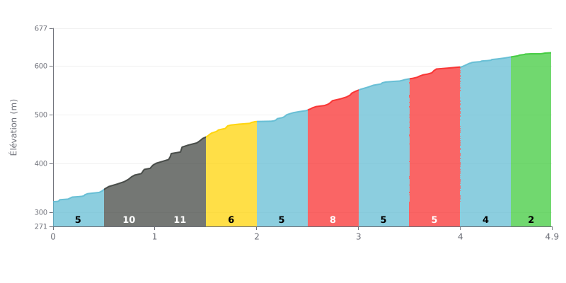
Difficulty breakdown: This Cat 2 climb is moderately hard over 4.9 km. The main challenge is the first third, with brutal gradients of 10% and 11% over the first 1.5 km. The rest of the climb is more even, with gradients between 2% and 8%, giving you some recovery.
Pacing tips:
1. Start easy: Don't let the steep opening percentages catch you out. Don't "blow up" in the first 1.5 km, so keep your effort in check.
2. Settle into a rhythm: After KM 1.5, find a sustainable tempo on the easier 4%-6% sections to hold your power all the way to the summit.
3. Save something for the finish: The final 400 meters at 2% let you ease off the effort and open up a little before the line.
4.9 km • 303 m D+
VAM: average climbing speed, based on elevation gain


Join thousands of cycling fans! Plan your rides, record your performance, track your progress and discover the finest climbs.
Live climb profile to pace your effort all the way to the top.

