
Gulmarg is a climb of 29.6 kilometers (hors catégorie). Gulmarg tops out at 2,728 m above sea level. It is located in n/a, Jammu and Kashmir, India. The average gradient is 5.2% with a maximum of 11.9%. The climb has 1525 meters of elevation gain.
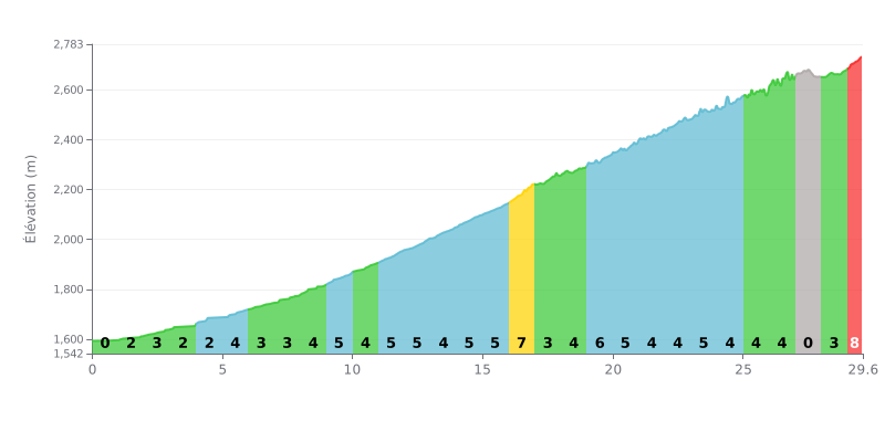
Difficulty breakdown: This 29.6 km HC climb ramps up progressively. The first half (KM 0-15) alternates between moderate gradients (2-5%), serving as a warm-up. The difficulty peaks at KM 16-17 with 7% and in the finale (KM 29-29.6) at 9%. The flat section at KM 27 offers a brief breather before the final effort.
Pacing tips:
1. Start easy: Use the first 15 km (average gradient <5%) to find your rhythm without redlining too early.
2. Save something for the two big kicks: Keep some in the tank for the short but steep 7% section (KM 16-17), and especially for the 9% finale.
3. Use the breather: The flat section at KM 27 is the perfect spot to recover and set up your final push.
29.6 km • 1525 m D+
VAM: average climbing speed, based on elevation gain


Join thousands of cycling fans! Plan your rides, record your performance, track your progress and discover the finest climbs.
Live climb profile to pace your effort all the way to the top.

