
Alto de Tinizara is a climb of 19.7 kilometers (hors catégorie). Alto de Tinizara tops out at 901 m above sea level. It is located in n/a, n/a, España. The average gradient is 4.5% with a maximum of 10.5%. The climb has 878 meters of elevation gain.
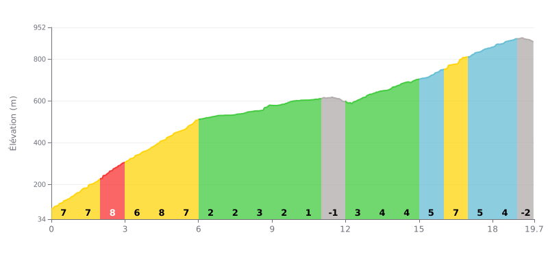
Difficulty breakdown: This climb has a varied gradient, split into two distinct sections. The first 6 km are tough, with 7-8% gradients, followed by a long 5 km false flat (1 to 3%, with even a slight downhill) where you can recover. The difficulty ramps back up over the last 4 km, with 5-6% gradients. The final 700m descent is a bit unusual.
Pacing advice:
1. Pace yourself: Don't burn out in the first 6 km, steep as they are. The central false flat is a crucial chance to recover at a steady tempo.
2. Save something for the finish: Keep some legs in reserve for the final section, from km 15 to km 19, where the gradient kicks back up (4-6%) before the final descent.
19.7 km • 878 m D+
VAM: average climbing speed, based on elevation gain


Join thousands of cycling fans! Plan your rides, record your performance, track your progress and discover the finest climbs.
Live climb profile to pace your effort all the way to the top.

