
Natha top is a climb of 46.1 kilometers (hors catégorie). Natha top tops out at 2,709 m above sea level. It is located in Chandarkot, Jammu and Kashmir, India. The average gradient is 5.4% with a maximum of 13.6%. The climb has 2512 meters of elevation gain.
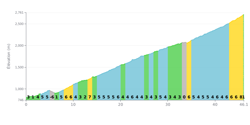
Difficulty analysis: Very long hors catégorie climb (46.1 km) with significant elevation gain (2512 m). The 5% average gradient is deceptive: the profile is uneven, alternating stretches at 1-3% with harder sections at 6-8%, especially over the last 10 km. The descent at KM 5.0-6.0 and the flat at KM 33.0-34.0 offer brief respites.
Pacing advice:
1. Pace yourself carefully over the first half, which is more moderate, to save your legs for the steeper finale.
2. Make the most of the short flat sections (KM 5-6 and KM 33-34) to recover actively by easing off the effort slightly without stopping.
3. Save some power for the final kilometres (KM 40-46), where gradients reach 7-8%, so you can keep your cadence up.
46.1 km • 2512 m D+
VAM: average climbing speed, based on elevation gain


Join thousands of cycling fans! Plan your rides, record your performance, track your progress and discover the finest climbs.
Live climb profile to pace your effort all the way to the top.

