
Aloumot is a climb of 3.0 kilometers (category 4). Aloumot tops out at 6 m above sea level. It is located in מועצה אזורית עמק הירדן, מחוז הצפון, ישראל. The average gradient is 0.3% with a maximum of 3.3%. The climb has 8 meters of elevation gain.
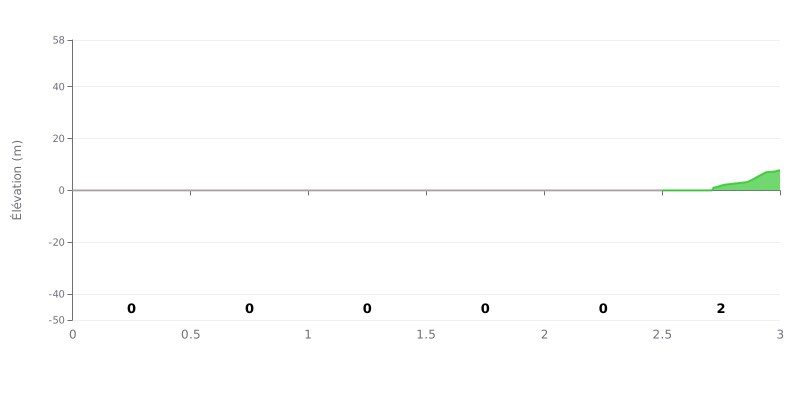
Difficulty breakdown: This 3 km climb is extremely easy. With only 8 m of total elevation gain and an average gradient of 0%, it's practically flat. The only real section is the final 500 m at a mild 2%. It's rated Category 4 purely because of that small final kick.
Pacing tips:
1. Steady rhythm: Keep a high cadence and a steady effort over the first 2.5 km, which are perfectly flat.
2. Short effort at the end: Save a little extra power for the last 500 m at 2%, the only real effort on the climb.
3. Gear choice: A flat-road gear works for the whole thing; you might drop a cog or two on the final section if there's a headwind.
3.0 km • 8 m D+
VAM: average climbing speed, based on elevation gain


Join thousands of cycling fans! Plan your rides, record your performance, track your progress and discover the finest climbs.
Live climb profile to pace your effort all the way to the top.

