
Al Za im is a climb of 23.8 kilometers (hors catégorie). Al Za im tops out at 615 m above sea level. It is located in מועצה אזורית מגילות ים המלח, יהודה ושומרון, Palestinian Territory. The average gradient is 3.2% with a maximum of 13.5%. The climb has 756 meters of elevation gain.
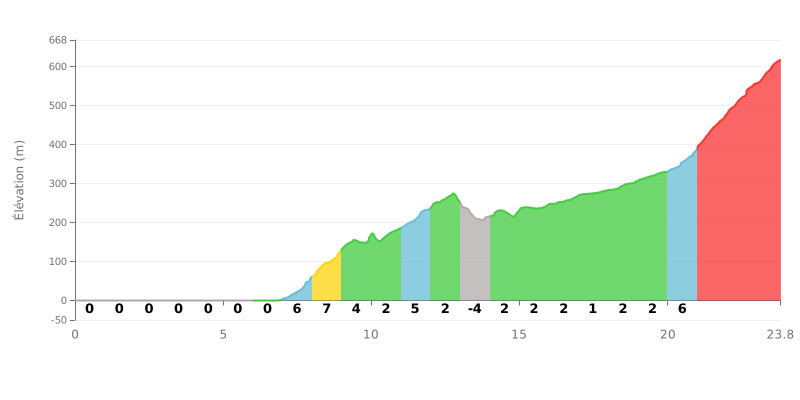
Difficulty analysis: This climb has an unusual profile, with 6 km of flat to start, followed by an irregular middle section (gradients from 1% to 8%) and a very demanding final (last 3 km at 8%). The difficulty lies in the accumulation of 756 m of climbing at the end of the ride, after a long distance already covered.
Pacing advice:
1. Make the most of the flat start by spinning along at an endurance pace without forcing it, the real climbing doesn't begin until KM 7.
2. Manage your pace through the middle section (KM 8-20), where the changing gradients mean you need to modulate your effort to avoid going into the red.
3. Save something for the final (from KM 20 onwards), the sustained 8% gradients over 4 km are where the race is decided.
23.8 km • 756 m D+
VAM: average climbing speed, based on elevation gain


Join thousands of cycling fans! Plan your rides, record your performance, track your progress and discover the finest climbs.
Live climb profile to pace your effort all the way to the top.

