
Macquarie Pass is a climb of 7.0 kilometers (category 1). Macquarie Pass tops out at 582 m above sea level. It is located in Shellharbour City Council, New South Wales, Australia. The average gradient is 7.5% with a maximum of 13.6%. The climb has 525 meters of elevation gain.
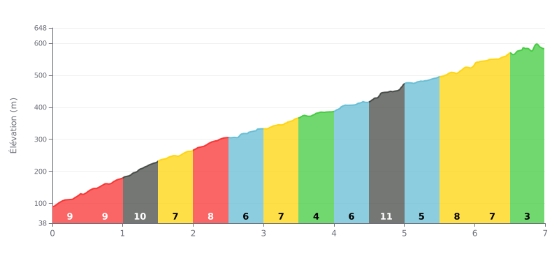
Difficulty breakdown: This Category 1 climb is genuinely hard, with an average gradient of 7.5% over 7 km. The first 2 km are tough, with several sections at 9-10%, and things get really nasty at 11% between 4.5 and 5.0 km, right after an easier stretch.
Pacing advice:
1. Start controlled: Hold back in the first few km (9-10%) or you'll blow up early.
2. Plan for the 11% kicker: Use the moderate sections (KM 3.5-4.0 at 4% and KM 5.0-5.5 at 4%) to recover before and after the steepest kilometre.
3. Keep a steady rhythm: Hold a constant power output and use the 6-7% sections to find your tempo again after the hard parts.
7.0 km • 525 m D+
VAM: average climbing speed, based on elevation gain


Join thousands of cycling fans! Plan your rides, record your performance, track your progress and discover the finest climbs.
Live climb profile to pace your effort all the way to the top.

