
Mugarsanti Pass is a climb of 27.3 kilometers (hors catégorie). Mugarsanti Pass tops out at 2,606 m above sea level. It is located in Pauathi, Uttarakhand, India. The average gradient is 9.5% with a maximum of 14.7%. The climb has 2592 meters of elevation gain.
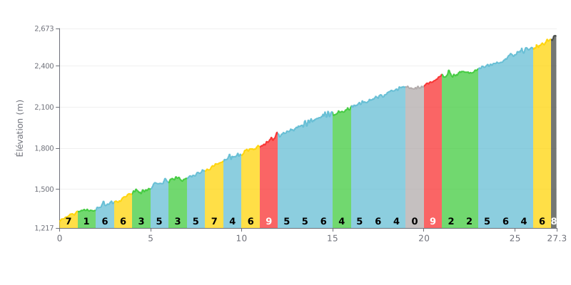
Difficulty breakdown: This hors catégorie climb is extremely demanding, with 2592m of total elevation gain over 27.3km. The average gradient of 9.5% is deceptive; the profile shows uneven difficulty with key sections: a kilometre at 9% (KM 11-12), a flat stretch at 0% (KM 19-20) followed by another 9% section (KM 20-21), and a brutal finish at 10%.
Pacing advice:
1. Ride within yourself from the opening kilometres, despite the moderate gradients (6-7%), to avoid burning matches before the critical sections.
2. Use the 0% flat (KM 19-20) to recover actively (spin easy) before the final push.
3. Save something in the tank for the last 300m at 10%, which will demand an explosive effort after more than 27km of climbing.
27.3 km • 2592 m D+
VAM: average climbing speed, based on elevation gain


Join thousands of cycling fans! Plan your rides, record your performance, track your progress and discover the finest climbs.
Live climb profile to pace your effort all the way to the top.

