
Horka is a climb of 6.3 kilometers (category 4). Horka tops out at 707 m above sea level. It is located in okres Bruntál, Moravskoslezsko, Česko. The average gradient is 3.0% with a maximum of 5.1%. The climb has 188 meters of elevation gain.
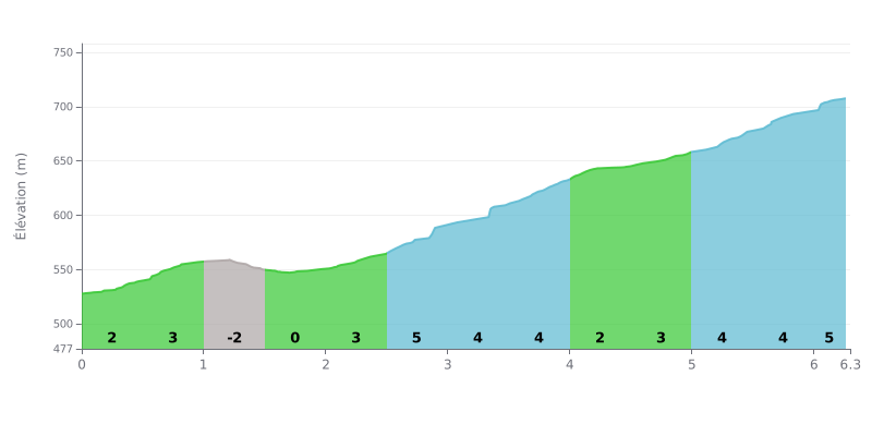
Difficulty analysis: This 4th category climb is relatively short (6.3 km) and not very steep (3% average). Its main difficulty lies in its irregularity, with a downhill and flat section between km 1.0 and 2.0 that breaks your rhythm, followed by the most demanding section between km 2.5 and 4.0 (4-5% gradients). The finish features a final 5% kicker.
Tips for pacing your effort:
1. Manage your rhythm: Use the downhill and flat section (km 1.0-2.0) to recover before tackling the steepest part.
2. Anticipate the changes: Hold a steady power output on the consistent climbs (km 2.5-4.0 and 5.0-6.0) and get ready for a final push over the last 300 meters at 5%.
6.3 km • 188 m D+
VAM: average climbing speed, based on elevation gain


Join thousands of cycling fans! Plan your rides, record your performance, track your progress and discover the finest climbs.
Live climb profile to pace your effort all the way to the top.

