
Lamahatta is a climb of 12.7 kilometers (hors catégorie). Lamahatta tops out at 1,827 m above sea level. It is located in n/a, West Bengal, India. The average gradient is 12.8% with a maximum of 21.5%. The climb has 1624 meters of elevation gain.
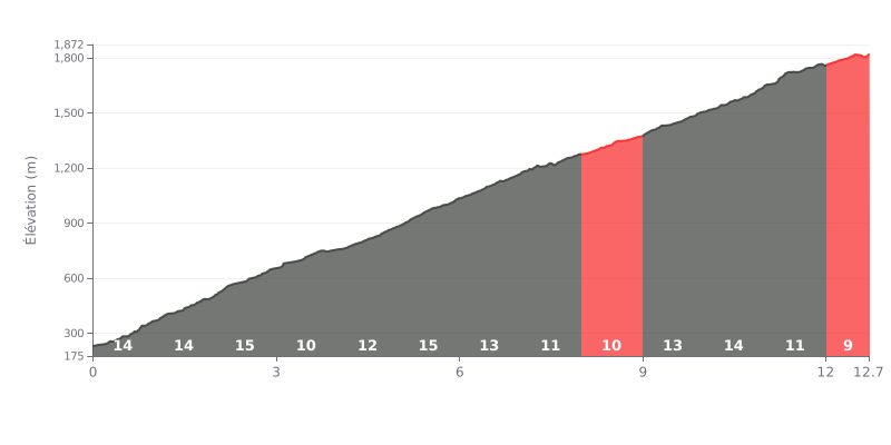
Difficulty analysis: This climb is extremely demanding, with an average gradient of 12.8% over 12.7 km. The difficulty is compounded by brutal sections, notably between km 5 and 6 (16%) and km 10 and 11 (15%), which will demand everything you've got.
How to manage the effort:
1. Pace yourself from the bottom: The first three kilometers at 14% are a real grind. Don't go out too hard, or you'll burn through your matches before the real work starts.
2. Make the most of the breathers: The stretches at 10% (km 3-4, 7-9) and the 9% finale are chances to recover a little and dial in your rhythm.
3. Be ready for the spikes: Save something in the tank for the two steepest ramps (16% and 15%), which are the crux of the climb.
12.7 km • 1624 m D+
VAM: average climbing speed, based on elevation gain


Join thousands of cycling fans! Plan your rides, record your performance, track your progress and discover the finest climbs.
Live climb profile to pace your effort all the way to the top.


Within 20 km