
Chinautla is a climb of 4.9 kilometers (category 1). Chinautla tops out at 1,450 m above sea level. It is located in Jocotales, Departamento de Guatemala, Guatemala. The average gradient is 6.1% with a maximum of 20.5%. The climb has 300 meters of elevation gain.
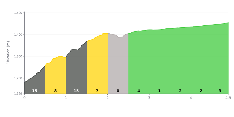
Difficulty breakdown: This climb has a two-part personality. The first two kilometers are very punchy, with three brutal sections (16%, 14%, 8%) accounting for almost 75% of the total elevation gain. After that it's a lot more rolling: a long, nearly flat stretch followed by easy gradients (0-3%). The "two-act" profile is the main challenge.
Pacing tips:
1. Start easy: Don't blow up in the opening metres. Spin up the 16% ramps in a comfortable gear to save your legs.
2. Active recovery: Use the flat kilometer (KM 2.0-2.5) to back off, drink, and get your heart rate back down before the finale.
3. Build back up: The last part, though not steep, means you have to bring the effort back after the break. Gradually raise your cadence and power over the final 500m.
4.9 km • 300 m D+
VAM: average climbing speed, based on elevation gain


Join thousands of cycling fans! Plan your rides, record your performance, track your progress and discover the finest climbs.
Live climb profile to pace your effort all the way to the top.

