
Portezuelo Maricunga is a climb of 128.7 kilometers (hors catégorie). Portezuelo Maricunga tops out at 4,125 m above sea level. It is located in Copiapó, Región de Atacama, Chile. The average gradient is 3.2% with a maximum of 12.8%. The climb has 4151 meters of elevation gain.
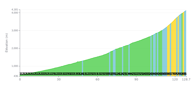
Difficulty analysis: This 128.7 km climb is an extreme endurance test. The difficulty lies in its length and its 4151m of elevation gain, but above all in the brutality of the finale. The last 20 km (from KM 108) average 6.4%, with sections at 7-8%, which makes them the decisive part.
Effort management tips:
1. Pacing: Keep a moderate, steady effort over the first 110 km (mostly 1-3% gradients). Whatever you do, don't go over the top in the early part of the climb.
2. Save something for the end: Hold back your legs and your head for the last hour, when the gradients get serious. That's where the climb is won or lost.
3. Smart fueling: Plan your nutrition and hydration carefully for the whole ride. You won't be able to make up for a deficit on the steep slopes of the final.
128.7 km • 4151 m D+
VAM: average climbing speed, based on elevation gain


Join thousands of cycling fans! Plan your rides, record your performance, track your progress and discover the finest climbs.
Live climb profile to pace your effort all the way to the top.

