
Inda maryam is a climb of 16.8 kilometers (hors catégorie). Inda maryam tops out at 2,576 m above sea level. It is located in Ch'ekh, ትግራይ تجراى, ኢትዮጵያ إثيوبيا. The average gradient is 6.2% with a maximum of 16.3%. The climb has 1035 meters of elevation gain.
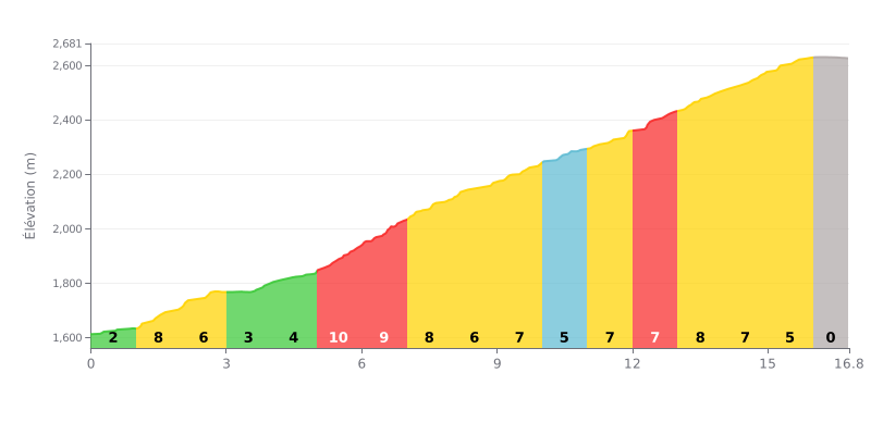
This hors catégorie climb is genuinely hard, with an average gradient of 6.2% over 16.8 km. The difficulty ramps up in a brutal central section between km 5 and 8, where the gradient hovers around 9% or even goes above it. The final km is a downhill false flat, but the average gradient across the whole climb stays high.
Pacing Tips1. Save something for the 5-8 km section, the steepest part of the climb. Don't go out too hard.
2. Settle into a steady rhythm on the 4-6% sections so you can recover before the parts above 8%.
3. Use the final km, which drops, to ease off the pressure and get ready for the finish.
16.8 km • 1035 m D+
VAM: average climbing speed, based on elevation gain


Join thousands of cycling fans! Plan your rides, record your performance, track your progress and discover the finest climbs.
Live climb profile to pace your effort all the way to the top.

